
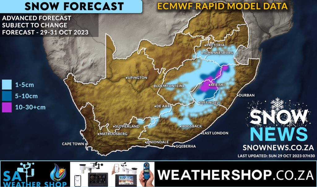
MODELS REMAIN CONSISTENT FOR SNOW Snow forecast remains positive The latest ECMWF (Rapid Model) snow forecast data continues to indicate widespread snowfall still possible from today through to Tuesday this week. This model data was updated this morning at 07h30 and correlates to what the weather models have been indicating to us for the past […]
Tag Archives: Kwa-zulu Natal
27
Oct
Oct
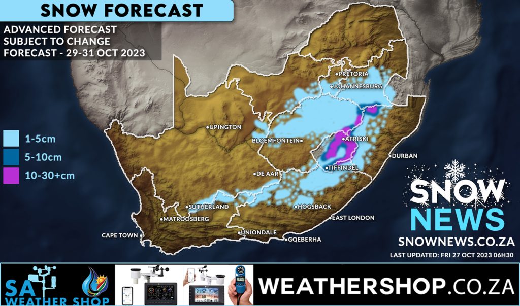
SNOWY DAYS AHEAD Weather models continue to show signs of some widespread snow starting Sunday 29 October 2023 through to Tuesday 32 October 2023. While models continue to indicate quite a wide area of snowfall this can of course change but weather models have also been quite consistent and have also shown signs of increased […]
17
Sep
Sep
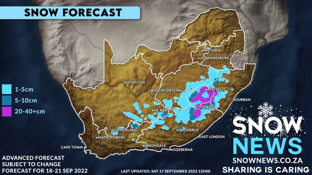
A cold front and upper-level trough system is bringing cold, wet weather and spring snowfalls to South Africa. Our weather models have shown substantial strengthening of this storm system with 40-50cm+ of snow expect across much of Lesotho and the Drakensberg mountain range. The models indicate light snowfall, 1-5+ cm, possible over the mountains of […]

20
Jul
Jul
Our Advanced weather modelling climate data is showing us the possibility of snowfalls for some of the high-ground of the Eastern Cape and Kwa-zulu Natal, the Southern Drakensberg (Underberg/Bulwer), KZN Midlands and most of Lesotho this weekend into next week. Our attached Map indicates where Snow News currently expect to see snowfalls occur in South […]