![]()
![]()
![]() MODELS REMAIN CONSISTENT FOR SNOW
MODELS REMAIN CONSISTENT FOR SNOW
Snow forecast remains positive
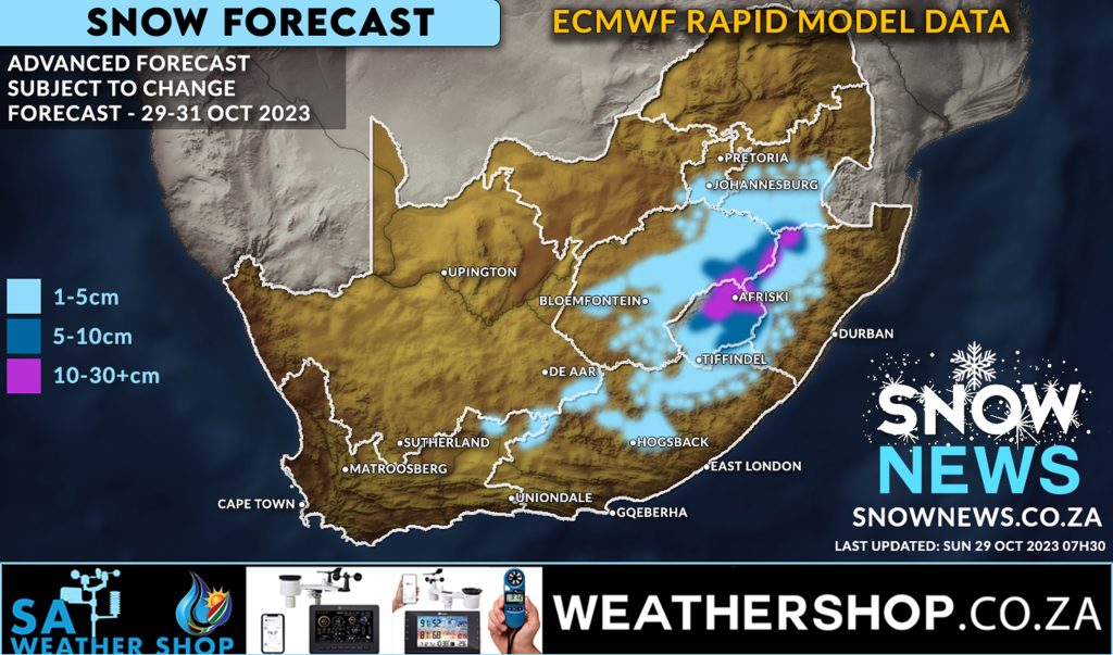
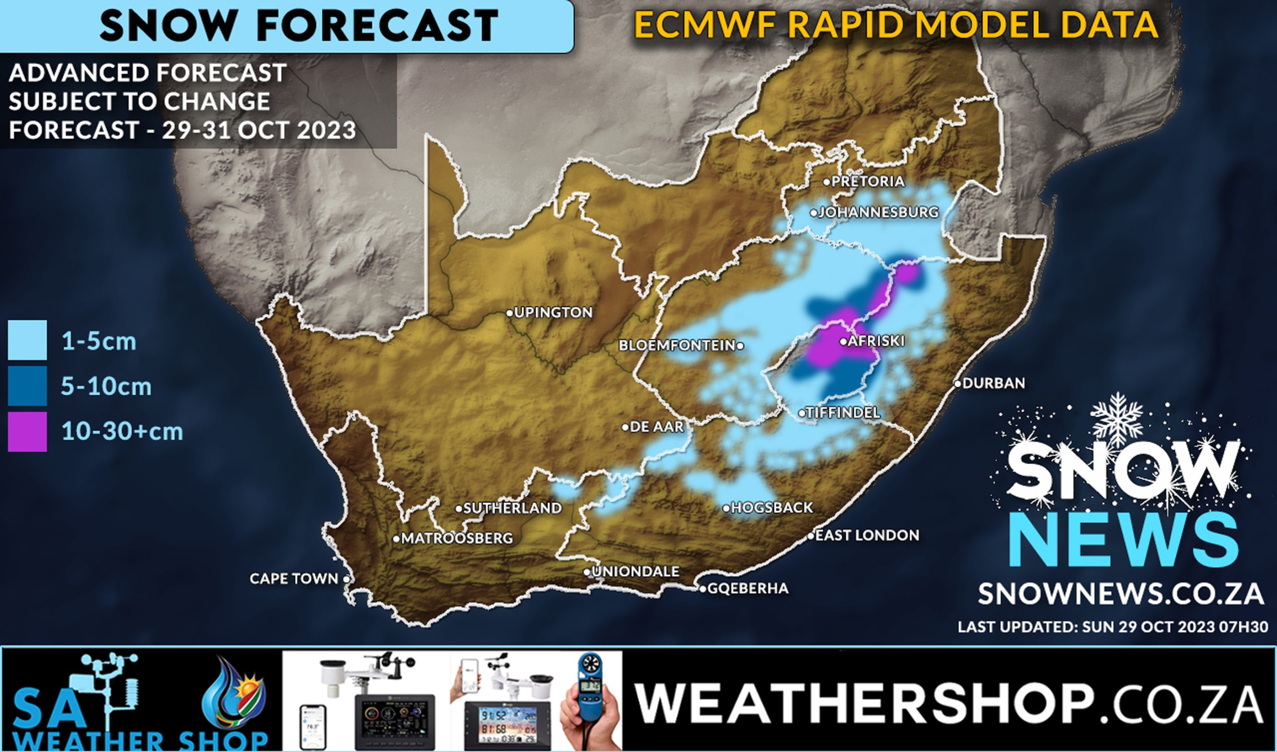
The latest ECMWF (Rapid Model) snow forecast data continues to indicate widespread snowfall still possible from today through to Tuesday this week.
This model data was updated this morning at 07h30 and correlates to what the weather models have been indicating to us for the past 5-7 days already.
Most light blue areas will most likely only see light snowfall, some may not see any at all, but as the models have remained more consistent than ever it’s still looking very promising.
Much heavier amounts of snowfall can be expected in Lesotho, across the Drakenberg mountain tops and along the escarpment up to towards Mpumalanga.
It is now raining steadily in the Southern Drakensberg and the cold air mass of the #coldfront is busy pushing inland as we speak creating ideal conditions for snowfall.
REMEMBER THIS IS A FORECAST AND NOT A GUARANTEE !!!
As we always say, don’t believe it’s snowing until you see it with your own eyes ![]()
We will keep you updated.
Please AVOID driving on icy roads and HEED to the warnings issued by the SA Weather Service.
We will keep this post updated. Stay warm and stay safe it’s going to be a very cold few days ahead. Winter in South Africa is NOT done with us yet !!!!!
Snow News – bringing you South Africa’s best snow forecasts and reports.
Send us all your photos and videos via whatsapp and please add the location where you took them.
Make sure to send us your photos on our Facebook page or via Whatsapp 078-503-4693
#snownews #snowmap #winter #snowinafrica #snowtober #southafrican #weatheraware
Make sure to follow our Facebook Page at https://web.facebook.com/SnowNews
Join our Free Telegram group at https://t.me/snownewsZA
Contact us on snow@snownews.co.za for any advertising enquiries.