
Snow has already fallen across parts of the country with more disruptive low-level snowfall still expected this evening and throughout Monday.
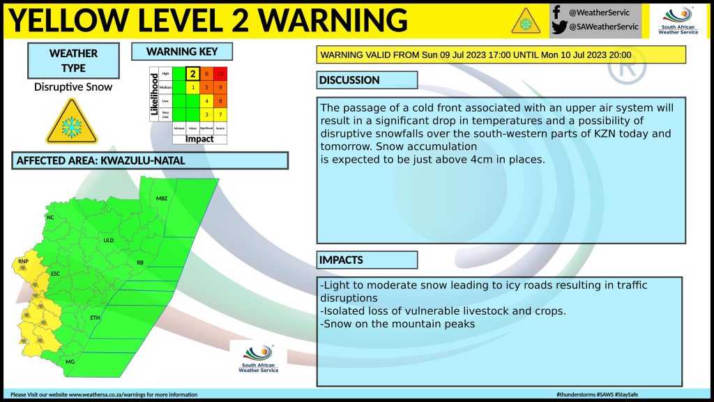
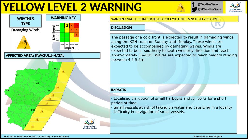
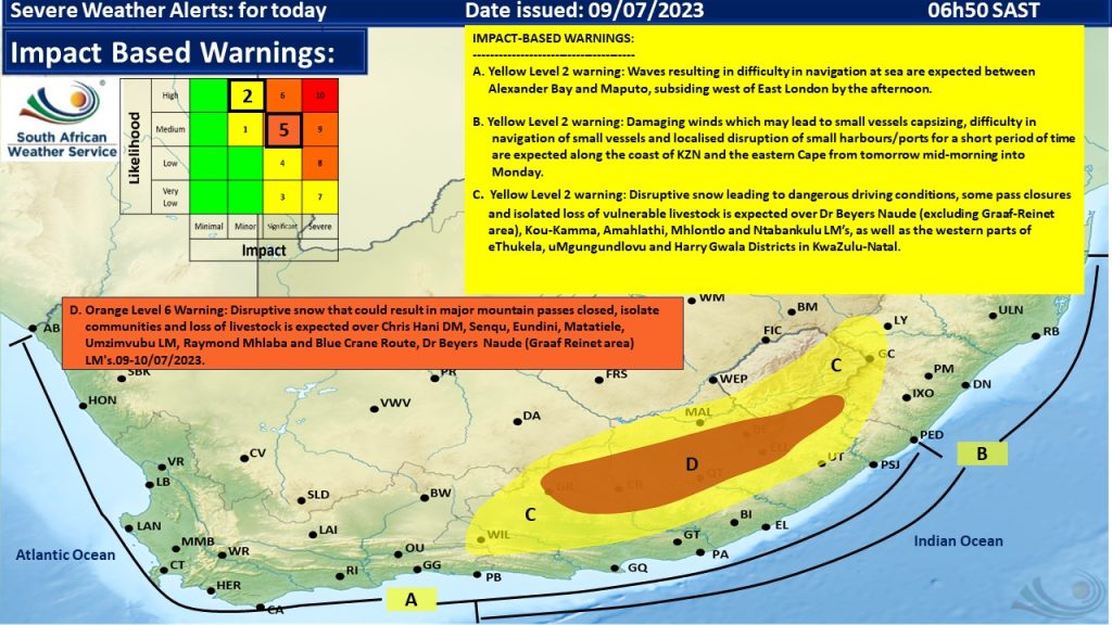
The South African Weather Service has issued warnings for Kwazulu-Natal for today as seen below.
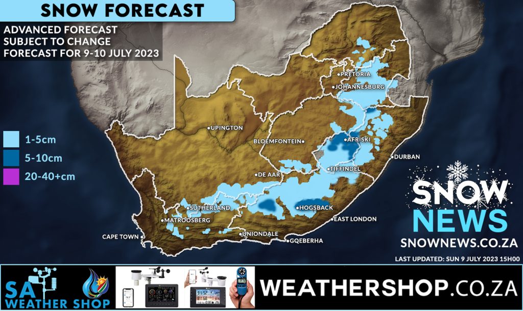
Parts of Southern and Eastern Gauteng still have a chance of seeing very light snow or flurries. Widespread snowfall is also possible and expected across a large part of Mpumalanga and slightly into Eswatini and the Limpopo province.
Much of the Natal midlands could see snow right up to Newcastle. Harrismith, Warden and Van Reenens could also see snowfalls which would make travel conditions dangerous so please stay in touch with the N3TC twitter feed.
Most places indicated on the map could expect to see between 1 and 5 cm of snow while up to 10 cm is possible in areas indicated on the below map but this is by no means any guarantee.
Please AVOID driving on icy roads and HEED to the warnings issued by the SA Weather Service.
We will keep this post updated. Stay warm and stay safe it’s going to be a very cold night tonight and some very cold days ahead still.
As always this forecast can change so don’t believe it’s snowing until you see it with your own eyes 😉

Make sure to send us your photos on our Facebook page or via Whatsapp 078-503-4693
Make sure to follow our Facebook Page at https://web.facebook.com/SnowNews
Join our Free Telegram group at https://t.me/snownewsZA