
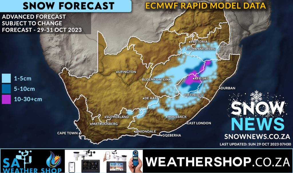
MODELS REMAIN CONSISTENT FOR SNOW Snow forecast remains positive The latest ECMWF (Rapid Model) snow forecast data continues to indicate widespread snowfall still possible from today through to Tuesday this week. This model data was updated this morning at 07h30 and correlates to what the weather models have been indicating to us for the past […]
27
Oct
Oct
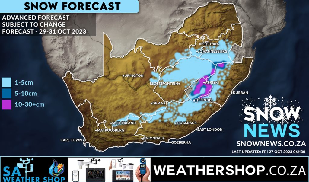
SNOWY DAYS AHEAD Weather models continue to show signs of some widespread snow starting Sunday 29 October 2023 through to Tuesday 32 October 2023. While models continue to indicate quite a wide area of snowfall this can of course change but weather models have also been quite consistent and have also shown signs of increased […]
09
Jul
Jul
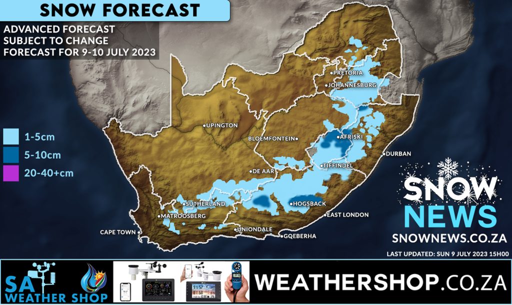
Snow has already fallen across parts of the country with more disruptive low-level snowfall still expected this evening and throughout Monday. The South African Weather Service has issued warnings for Kwazulu-Natal for today as seen below. Parts of Southern and Eastern Gauteng still have a chance of seeing very light snow or flurries. Widespread snowfall […]
06
Jul
Jul
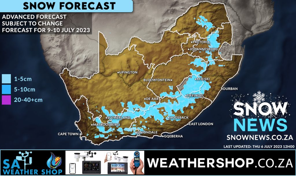
POSSIBLE WIDESPREAD SNOWFALLS This forecast model is now 3 days in advance of snowfalls expected to start Sunday. There has already been some signs of weakening in the forecast for snowfalls in Gauteng BUT as this is an advanced forecast this can and will still change. We will re-look at our weather models tomorrow (Friday […]
17
May
May
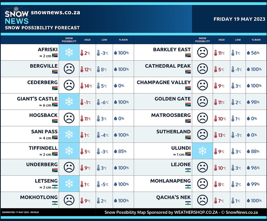
Our new forecast data shows a good likelihood of snowfalls possible for parts of Lesotho and the Drakensberg tomorrow into Friday this week including Sani Pass. We hope you like this new meteogram format which concentrates on areas that have a higher likelihood of seeing snowfall versus our previous maps which show wider areas of […]

20
Apr
Apr
Our advanced forecast data show snowfalls possible for the highest peaks of Lesotho, mountainous areas of the Eastern Cape and parts of the Northern Cape this weekend as per our attached snow forecast map. Snowfall is expected mostly at higher elevations with a small chance of some low-level ground snow in parts of the Northern […]
04
Apr
Apr
The first snow has fallen on the Southern Drakensberg last night. Photos are streaming from our community here in Underberg, home of Snow News SA. Winter is now finally moving in with more snowfalls possible this coming weekend. This snow fall is just in time for the Splashy Fen music festival starting in just a […]
11
Nov
Nov
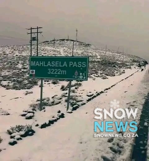
It has snowed overnight and this morning in Lesotho at the Mahlasela pass near Afriski. Our eyewitness report confirmed this early this morning and that snow is still falling. We also have confirmation of this from the Disaster Management Authority of Lesotho. Amazing to see snow in November !!!! Make sure to send us your […]

22
Sep
Sep
A beautiful short timelapse filmed by Mitchell Krog for Snow News South Africa. Taken from Lake Naverone in the Southern Drakensberg on Astronomical Spring day 20 September 2022. Make sure to send us your photos on our Facebook page or via Whatsapp 078-503-4693 #snownews #snowmap #winter #snowinafrica Make sure to follow our Facebook Page at […]
17
Sep
Sep
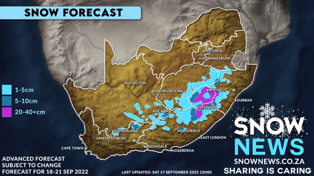
A cold front and upper-level trough system is bringing cold, wet weather and spring snowfalls to South Africa. Our weather models have shown substantial strengthening of this storm system with 40-50cm+ of snow expect across much of Lesotho and the Drakensberg mountain range. The models indicate light snowfall, 1-5+ cm, possible over the mountains of […]