![]()
![]()
![]() SNOWY DAYS AHEAD
SNOWY DAYS AHEAD ![]()
![]()
![]()
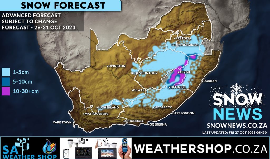
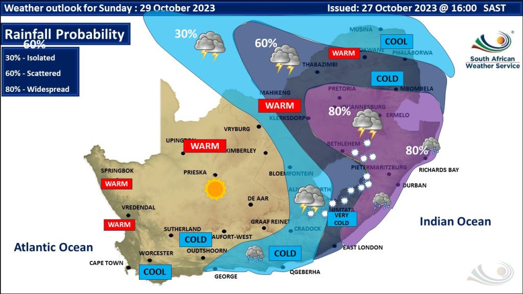
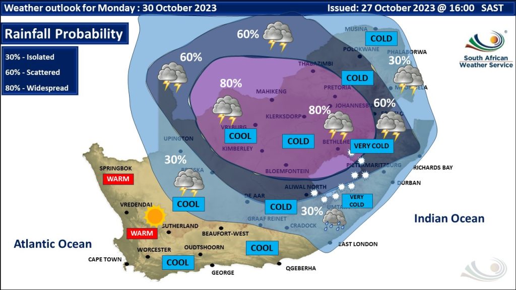
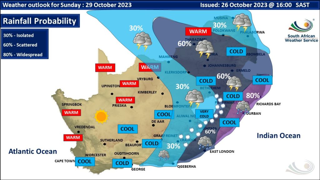
Weather models continue to show signs of some widespread snow starting Sunday 29 October 2023 through to Tuesday 32 October 2023.
While models continue to indicate quite a wide area of snowfall this can of course change but weather models have also been quite consistent and have also shown signs of increased snowfall distribution versus our last map posted on Wednesday.
It IS going to be a very ![]() COLD WEEKEND extending into next week with very low temperatures and possibly disruptive snow in some provinces coupled with widespread rainfall too.
COLD WEEKEND extending into next week with very low temperatures and possibly disruptive snow in some provinces coupled with widespread rainfall too.
Many areas in light blue may only see light flurries or nothing at all and this map is merely a guide and may change as weather conditions develop.
PLEASE PAY ATTENTION TO ALL WARNINGS ISSUED BY THE SA WEATHER SERVICE WHICH WE WILL ALSO SHARE TO THIS PAGE AS THEY ARE ISSUED.
Please AVOID driving on icy roads and HEED to the warnings issued by the SA Weather Service.
We will keep this post updated. Stay warm and stay safe it’s going to be a very cold few days ahead. Winter in South Africa is NOT done with us yet !!!!!
Snow News – bringing you South Africa’s best snow forecasts and reports.
Send us all your photos and videos via whatsapp and please add the location where you took them.
Make sure to send us your photos on our Facebook page or via Whatsapp 078-503-4693
#snownews #snowmap #winter #snowinafrica #snowtober #southafrican #weatheraware
Make sure to follow our Facebook Page at https://web.facebook.com/SnowNews
Join our Free Telegram group at https://t.me/snownewsZA
Contact us on snow@snownews.co.za for any advertising enquiries.
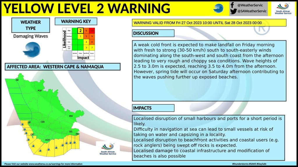
Media Release from South African Weather Services
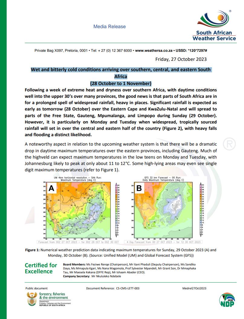
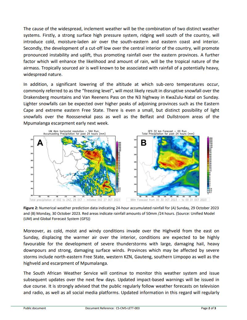
Wet and bitterly cold conditions arriving over southern, central, and eastern South Africa (28 October to 1 November)