![]()
![]()
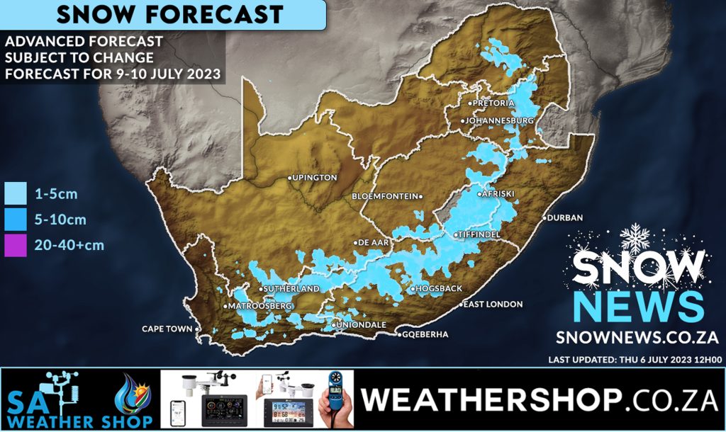
![]() POSSIBLE WIDESPREAD SNOWFALLS
POSSIBLE WIDESPREAD SNOWFALLS
This forecast model is now 3 days in advance of snowfalls expected to start Sunday.
There has already been some signs of weakening in the forecast for snowfalls in Gauteng BUT as this is an advanced forecast this can and will still change.
We will re-look at our weather models tomorrow (Friday 7 July) which will then have a higher likelihood of showing a slightly more accurate forecast.
It’s still looking very promising at this stage but sadly this current data does not show a great likelihood for Gauteng but a lot can and will change still so …. keep the faith![]() remember mother nature is in control not us or weather models.
remember mother nature is in control not us or weather models.
And remember … as we always say …. don’t believe us or anyone else, only believe it’s snowing when you actually see that beautiful white fluffy stuff falling from the sky with your own eyes.
We will keep you updated.
Visit our sponsor www.weathershop.co.za for SA’s widest selection of #weatherstations and Weather equipment.
REMEMBER > Send us all your photos and videos via whatsapp and please add the location where you took them.
Make sure to send us your photos on our Facebook page or via Whatsapp 078-503-4693
#snownews #snowmap #winter #snowinafrica
Make sure to follow our Facebook Page at https://web.facebook.com/SnowNews
Join our Free Telegram group at https://t.me/snownewsZA
Contact us on snow@snownews.co.za for any advertising enquiries.