The Snow News Team is confident we will see some widespread Snowfall from today through Saturday and possible into Sunday.
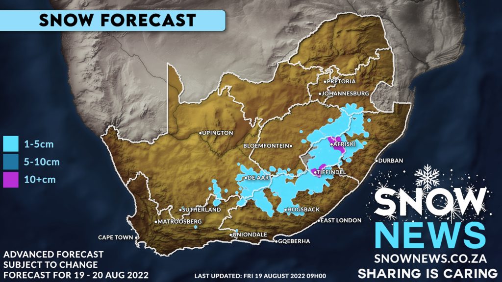
The South Eastern parts of Northern Cape, central and northern parts of the Eastern Cape, Southern Drakensberg (Underberg, Bulwer) across the KZN midlands as far as Newcastle and also the extreme south-eastern Free State could see some pretty white stuff falling to the ground over the next 2 days.
Much of Lesotho will see snowfall with areas like Afriski and Tiffendel seeing 10cm+ of fresh snowfalls.
We use a very advanced rapid weather model for this forecast prediction and we are growing every more confident that we shall see snow as the weather models have been consistent for several days.
Keep in mind this is an advanced forecast so it is subject to change.
We will keep you updated, have a fantastic week and Stay Warm it’s going to be a VERY cold weekend for most of the country.
Our winter is most definitely still not over and the Snow News team is still expecting more snow ahead as our seasons slowly start shifting towards Spring. We predict there could be snow in September possibly even October this year.
Make sure to send us your photos on our Facebook page or via Whatsapp
#snownews #snowmap #winter #snowinafrica
Make sure to follow our Facebook Page at https://web.facebook.com/SnowNews
Join our Free Telegram group at https://t.me/snownewsZA
Contact us on snow@snownews.co.za for any advertising enquiries.